Make your Construction Project Advance Live and precise information on security, remote area monitoring, risk evaluation, and perimeter management.
Real-Time Aerial View: Enables live, remote visibility of ground operations.
Security Monitoring: Provides instant surveillance for quick threat response.
Remote Inspections: Offers safe and efficient access to hard-to-reach or hazardous areas.
Risk Assessment: Allows observation and analysis from a safe distance.
Perimeter Control: Strengthens boundary monitoring and rapid incident response.
Informed Decisions: Delivers accurate, real-time data for proactive action.
Low-Light Monitoring: Enables effective observation during nighttime or low-visibility conditions.
Flexible & Mobile: Offers greater coverage and mobility compared to fixed cameras.
Cost-Effective: Reduces expenses associated with traditional stationary surveillance systems.
Thermal & Night Vision: Detects movement, heat signatures, and irregularities even in complete darkness.
Real-Time Observation: Provides live monitoring of remote or hard-to-reach areas.
Enhanced Security: Improves management, control, and protection of assets after dark.
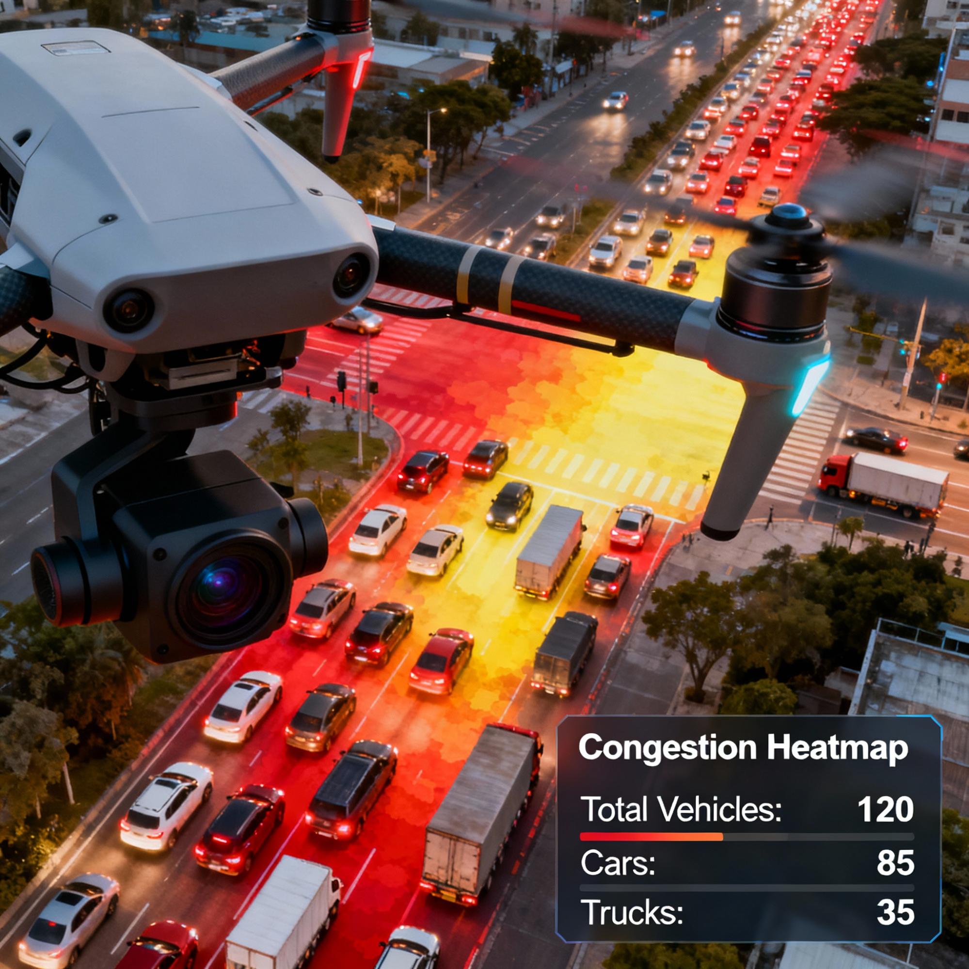
Aerial Data Collection: Uses drones to capture real-time traffic visuals over large areas.
Vehicle Detection: Counts and categorizes vehicles by size, type, or class.
Congestion Mapping: Creates heatmaps to identify bottlenecks and high-traffic zones.
Behavioral Insights: Analyzes driver behavior, speed patterns, and flow efficiency.
Smart Planning Support: Assists authorities in improving road safety and optimizing infrastructure design.
Cost & Time Efficiency: Offers faster, more comprehensive analysis compared to traditional ground-based methods.
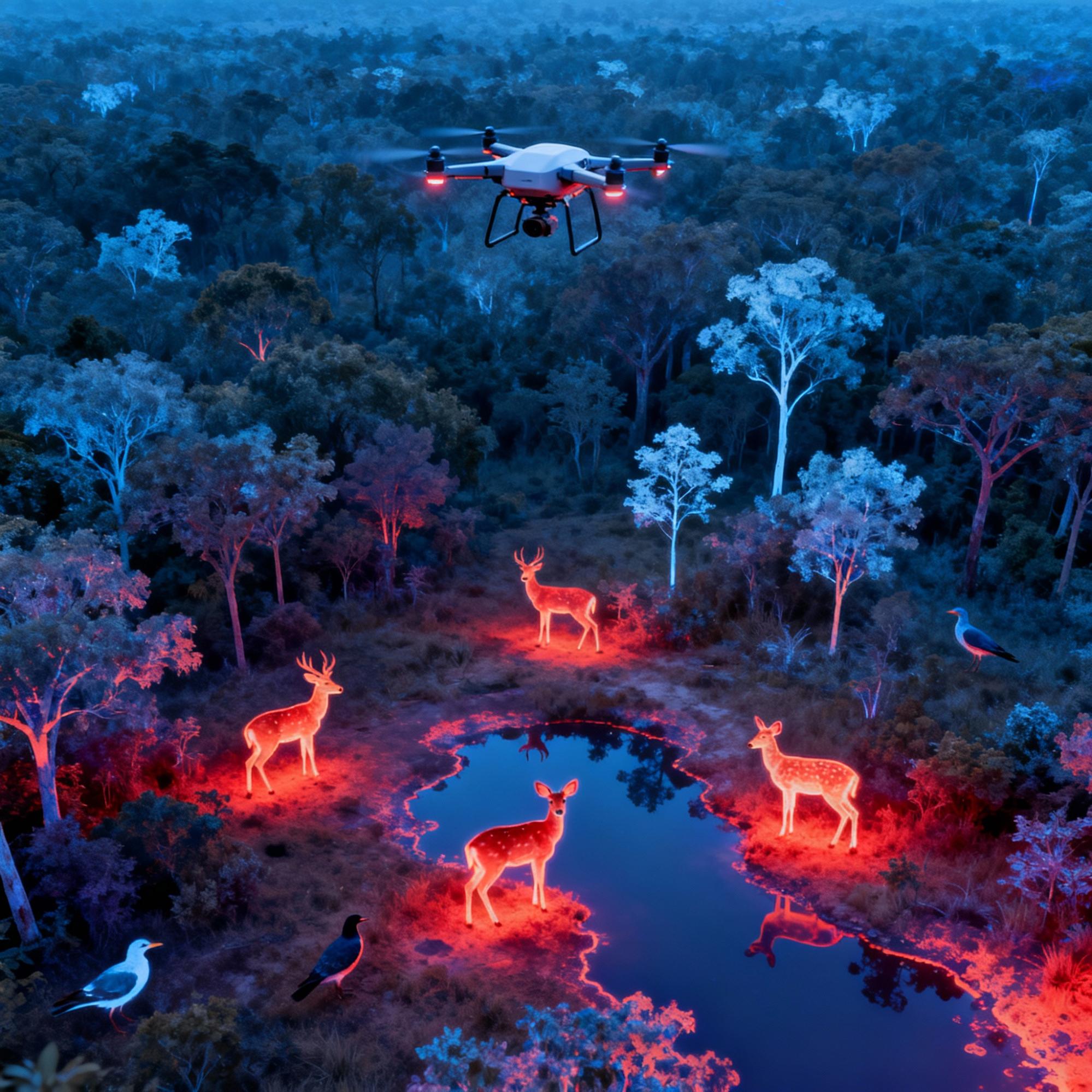
Non-Intrusive Monitoring: Drones enable observation of wildlife without disturbing natural behavior.
High-Resolution Imaging: Captures detailed visuals of habitats, animal movements, and vegetation health.
Thermal & Infrared Detection: Tracks nocturnal animals and detects hidden wildlife activity.
Anti-Poaching Support: Identifies and monitors illegal activities such as poaching or deforestation.
Ecosystem Assessment: Evaluates habitat conditions and the effects of human interference.
Real-Time Data Access: Provides instant or recorded insights for conservation planning and management.
Biodiversity Protection: Aids researchers and forest departments in preserving endangered species and ecosystems.
Aerial Monitoring: Provides a wide, unobstructed aerial view of public events and large gatherings.
Threat Detection: Enables quick identification and response to potential security risks.
Enhanced Coordination: Supports ground teams by offering real-time visual data for better decision-making.
Crowd Management: Helps monitor crowd movement and prevent congestion or disturbances.
Event Safety: Ensures a higher level of safety and situational awareness for attendees.
Adding {{itemName}} to cart
Added {{itemName}} to cart